OCEANWEATHER INC
Oceanweather inc. is a weather forecasting company which i found affiliated with other companies in my research.
Here i wanted to see what " high-level technology" is being used because a quick read had no mention of satellites which are attributed to our ability to forecast the weather.
I also wanted to verify if they were affiliated with satellite operators or have close ties to the same individual employees, companies, organizations and business partners,
If you were planning on a quick read you were mistaken. The trail is a long, interwoven , back and forth journey. But i assure you it will be worth the time to help understand something i consider very important.
If you want the basic idea I have provided a "Quick look" section below which attempts to show at a glance how i made this connection.
I have also included a spread sheet showing a connection chart and quick reference lists.
The biggest issue i had at first, and still hear many others that haven't taken the time to look into this this is that there are thousands of employees working for hundreds of companies that would know something is wrong and
1) It could be kept a secret.
2) There would be whistle blowers
3) Rival companies would have exposed each other.
This is at first is a very logical argument which is why i took the time to look into them closely. I feel the time spent looking into the background of these organizations carefully will be worth while and is absolutely required to understand that the companies involved are all in some way affiliated.
They have the same employees moving between them, they have the same affiliated partners, they have the same consultants, they use the same engineers, they use the same monitoring companies or have the same financial backers or business partners.
I understand that the field and expertise for the industry may be specialized so please follow the links before deciding and make your own connections.
This understanding is fundamental to this topic and many topics discussed on this website, without this understanding the idea can, (and i did agree at first) seem far fetched
QUICK LOOK
My Intent for "Quick look" was to prevent people skipping over the subject mainly due to its difficulty to understand and accept but also due to the time required to properly research this information. I hope it will be enough to encourage further research.
Found this link to oceanweather inc on Avista Ventures "terms" page http://www.avista-ventures.com/terms.php
AFFILIATES
Avista Ventures Marine Services, NOAA, NCAR, ONR, NASA, Atmospheric Environment Service (AES) of Canada, Canadian Meteorological Center, Norwegian Meteorological Service, US Navy, US Navy forecast centers, US Army Corps of Engineer, Korean Ocean Research and Development Institute,
International Civil Aviation Organization (ICAO) a specialized body of the United Nations
JCOMM who is in a joint program with The World Meterorogical Organization (WMO) (also a specialized body of the United Nations) and the Intergovernmental Oceanographic Commission (OIC)
JOINT PROGRAMS
Joint Industry Projects (JIPs)
GUMSHOE , WINX), BSCOMP, CSCOMP), BOMOS, RASMOS, SIMOS, SEAMOS, Nile Delta, CASMOS, NESS/NUG/NEXT, WAX/WANE, CARIMOS).
Major new continuous hindcasts by Oceanweather include a 40-year hindcast of the North Atlantic (AES40, Swail and Cox, 2000) and the entire globe (GROW, Cox and Swail, 2001).
NASA's SEASAT, NSCAT and QuikSCAT programs
NOAA VOS (Voluntary Observing Ship) program
in FAQs found real time ship observations come from he Voluntary Observing Ship program (VOS) and the NOAA VOS page gives more info here http://www.vos.noaa.gov/
Formed in 1977 Oceanweather inc. functions as a specialized consulting firm serving the coastal and ocean engineering communities and claim capacity to integrate several areas of expertise.
Oceanweather's aim to consistently develop and apply high-level technology in the areas of marine meteorology, ocean wave and current specification, ocean engineering, and statistics of environmental data and has performed dedicated hindcast studies and Joint Industry Projects (JIPs) in virtually every ocean basin in the world.
They also perform basic and applied research in marine meteorology and ocean response numerical modeling.
Since their formation they have been fully engaged with support from both private and public sectors .
Sported by US and foreign government agencies it has an international reputation and actively participates in international scientific conferences and senior research staff have contributed over 40 papers within the past 10 years to journals and major conference proceedings with open publications going back to 1988.
Oceanweathers achivements, research and programs include
-Developed global and regional ocean wave models, which became operational for a time at US NOAA and US Navy forecast centers, the Canadian Meteorological Center and the Norwegian Meteorological Service
-Tropical cyclone boundary layer model has been implemented by the US Navy, the US Army Corps of Engineers and the Korean Ocean Research and Development Institute
- identified critical attributes of meteorological forcing for successful ocean response model hindcasts and forecasts. Studies were supported by NOAA, ONR, NASA and Atmospheric Environment Service (AES) of Canada.
-Development and evaluation of microwave remote sensors to measure ocean surface roughness, wind and sea state.
-Oceanweather has contributed to NASA's SEASAT, NSCAT and QuikSCAT programs
-Assessment of the North Atlantic and global ocean wave climate trend and variability over the past 40-years based on the NOAA NCAR Reanalysis Products
Dr. Cardone helped evaluate prototype airborne remote microwave sensors in the 1960s and the sensors on SKYLAB in the early 1970s.
Dr. Cardone was a member of WAM, an international team of ocean wave modelers active during the 1980s and coauthored the WAM third-generation (3G) deep water wave model. He is presently a member of the Senior Advisory Panel on the EC sponsored MAXWAVE Project.
The "Hindcast appraoch" mentioned a satellite.
It is a program which measures Wave heights, wave periods , currents and storm surges etc.
I always find that the data aquired by a satellite can always be from other sources. In this case, as highlighted in red below instrumented platforms or moored buoys were used for 20 years and buoys are still used in new long term wave hindcast of the global oceans called "Global Reanalysis of Ocean Waves (GROW)".
And I always wonder how a satellite could measure and provide the data of Waves and currents. This is obviously better achieved by on the ocean devices.
Again i would also like to point out the Use of terminology like Joint Industry Projects, (JIPs)
http://www.oceanweather.com/research/HindcastApproach.html
"At a few sites, instrumented platforms or moored buoys have acquired data over the past twenty years or so, and satellite altimeters have measured global wave heights over about a ten-year period. However, while such data make it technically possible to compute extremes directly from the measurements, the reliability of such estimates must be questioned at least on the grounds that natural climate variability on decadal time scales is not properly represented
Principals at the company pioneered the development and application of Hindcast during tenure at New York University in the 1960s and 1970s and applied Hindcast to many new offshore development projects launched within the past two decades (see a recent review by Cardone,1999).
The prototype for modern Hindcast studies was the Gulf of Mexico Ocean Data Gathering Program (ODGP) in 1969 and included an extensive measurement program, a wave hindcast model development and calibration phase and a hindcast phase allowing reliable extreme wave heights / periods associated with hurricanes
(Cardone et al., 1976, Ward et al., 1979; Haring and Heideman, 1978).
Since ODGP, hundreds of studies have been carried out to develop reliable extreme wind, wave, surge and current design estimates for design of specific offshore and coastal structure supported jointly by many operators refereed to as Joint Industry Projects, or JIPs . A recent review is given in Cardone et al. (2000)
Major JIPs administered and/or carried out by Oceanweather have addressed the following
the Gulf of Mexico (GUMSHOE ad WINX), the Bering Sea (BSCOMP) Chuckchi Sea (CSCOMP), Brazil (BOMOS), Russian Arctic Seas (RASMOS), Sakhalin Island (SIMOS), South China Sea (SEAMOS), Nile Delta of Egypt (Nile Delta), Caspian Sea (CASMOS), North Sea (NESS/NUG/NEXT), West Africa (WAX/WANE) and the Caribbean Sea (CARIMOS). Major new continuous hindcasts by Oceanweather include a 40-year hindcast of the North Atlantic (AES40, Swail and Cox, 2000) and the entire globe (GROW, Cox and Swail, 2001).
Oceanweather's new long term wave hindcast of the global oceans (GROW) indicate that errors in hindcasts validated against wave measurements from buoys and satellite altimeters are acceptably low for many design purposes."
They then go on to say
"Cardone et al., (1995) also demonstrated that where surface wind fields are specified using kinematic reanalysis techniques which take advantage of the enhanced data coverage in areas of dense buoy and/or offshore platform measurement arrays (e.g. off the east and west coasts of North America and in and around the North Sea
New long term wave hindcast of the global oceans (GROW) indicate that errors in hindcasts validated against wave measurements from buoys and satellite altimeters are acceptably low.
Now i question that if a satellite is able to measure the data required and only 3 are required to provide global coverage why would areas of areas of dense buoy and platforms be required for "enhanced data coverage"?
The reference provided mentioning satelilites was

|
On the use of in-situ and satellite wave measurements for evaluation of wave hindcasts.pdf Size : 1643.862 Kb Type : pdf |
3 methods of measurement were mention in section 3- Validation Datasets.
1) Buoys and Platforms(in-situ) located in the northern hemisphere from a variety of sources.
U.S. buoy data came from the NOAA Marine Environmental Buoy Databas, Canadian buoy data came from the Marine Environmental Data Service andthe remaining buoy and platform data (notably the northeast Atlantic and northwest Pacific) came from the Comprehensive Ocean Atmosphere Data Set (COADS)
In-situ comparison showed Overall, AES40 has similar bias with lower SI and higher correlation coefficients when compared to GROW at the buoys/platforms and talks about "experimental buoys available inthe 70s and early 80s"
GROW and AES40 and COADS data
2) Ocean Weather Station Bravo (OWS) from the US National Climatic Data Center.
Ocean Weather Ship Bravo, located in the North Atlantic, gives an opportunity to evaluate the hindcasts well away from the coast and for the time period 1958-1974 where the buoy observations are not available.
So Weather Ships are yet another alternative to a satellite for weather monitoring.
The idea for Weather ships was proposed in 1921 to help support the coming of Transatlantic avaiation not only for weather observations but also Radio communication stations. and proved so useful that the International Civil Aviation Organization (ICAO) ( 1 ) established a global network of weather ships in 1948 with 13 to be supplied by Canada, the United States, and Europe.
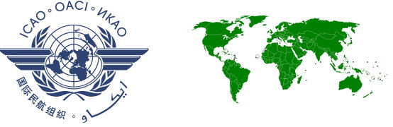
ICAO is a specialized agency of the United Nations which has 191 member states.
Below is their logo and membership states in green.
You may recognize the design as the flat earth map and can see that basically every country is a member.
ICAO controls most of the aviation regulations and activities and are responsible
Please check out their affiliates
International Air Transport Association and the huge list of strategic partners.
3) Satellite Altimeters from the ERS-1, ERS-2 and TOPEX/Poseidon.
ERS-1/2 altimeter data sets were obtained from the Ifremer CD-ROM data set, while TOPEX data (GDR Generation-B CD-ROM set) was obtained from the NASA Physical Oceanography Distributed Active Archive Center at the Jet Propulsion Laboratory/California Institute of Technology.
look for Cotton and Carter (1994).
Interesting comment to look for below as how do the sat altimeters get contaminated?
"synoptic times using a ±3-hour window. Additional quality control was performed for measurements along land and ice edges where some contamination of the altimeter wave measurements was encountered despite rigorous checking of ice/quality control flags available with each data set. "